- Home
- →
- Attractions
- →
- Pinsk castle archaeological site
Pinsk castle archaeological site
Pinsk is one of the cities where it was difficult to recover details the historical topography. Studying of city began in the late 50s and early 60s of this century when people not clarified the typical conditions of the location of ancient cities. Besides the reconstruction of the ancient center in Pinsk ahead knowledge and destroyed the terrain and the remains of ancient fortifications. It makes difficult to localize elements of the ancient city at the present a modified relief. This led to the fact that even experienced archaeologists could not exactly tied to the individual elements of the ancient city area.
To determine the location of the citadel and the roundabout of the ancient Pinsk was used city plan 1794 that revealed in 1965 in Moscow in the Central State Military Historical Archive. At that plan you could to view not only the general outline of the planning structure of the ancient city, but the remains of ancient fortifications also.
Citadel is most fortified center of the city. It had a rounded shape and measures approximately 97x74 yards (194x148 m, approximately 10767 square meters). But the legend made up to this plan, it is referred to as «ruined castles». Citadel could control navigation on the Pripyat River in the south to Volyn, west up the Pina and the east - down the Pripyat after its merger with Pina. This control function was the primary when choosing a place of erection of the ancient citadel of Pinsk, on the left bank of the sublime river Pipa.
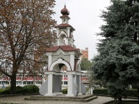
On the citadel located Demetrius Church.
Defensive moat citadel covers like horseshoe citadel from the west, north and east and is supported at both ends on the river Pina. First its depth is unknown. Judging by the width of the pit, he greatly enhanced defensive capabilities citadel. At present, the western section of the bottom of the pit of the citadel passes Str.Tchaikovsky. The slopes of the citadel and the roundabout of the city, separated by a moat, built up, plowed gardens, reflect on the general outlines of the elements of the ancient city on this site. But in ancient times, obviously defensive ramparts with bulk structures towered around the perimeter of the citadel ( «Castle» ). Perhaps, on the south side, they were not as powerful as in the north, the floor side, because the southern side of the additional means of defense served as the river itself.
Roundabout ancient city of Pinsk has a wide arc outside the citadel defensive ditch, leaning on river Pina its western and eastern ends. Western section of the roundabout of the city is within the Street. A.M. Gorky and his outer slopes are easily traced on the eastern side of the southern section of the street, adjacent to the territory of the shipyard. Even today day surface city roundabout 3-4 m rises above the street. Gorky laid strewn on the defensive moat city roundabout. The northern section of the city occupied the space of the roundabout to the north of the citadel defensive ditch and extended to the northern limits pl. Lenin, without reaching the street Gorky.
Projecting a modern city plan is a change of the relief on the plan in 1794, we also get the opportunity to define the eastern limits of the city roundabout in the eastern part of today's square Lenin. Confirm the location of the eastern borders of the roundabout at the eastern edge of the town square. Lenin posts written sources in 1649 in one of them mentioned that the eastern side of the territory near the town roundabout Jesuit College was accessible only by a bridge, pass through the defensive ditch. Mention defensive moat and bridge over it in 1649 confirms the assumption that the eastern border of the city roundabout.
Trading quarter ancient Pinsk semicircle covered roundabout city, extending in an easterly direction. Focusing on the modern city street network, it can be said that trading quarter was situated within the street Zavalnaya. The name of the street suggests that it was held for the shaft, the ancient fortifications - the shaft and the moat, which restricted settlement with the west and north sides of the city. On the eastern side Posad limited defensive ditch at the bottom of which is currently in st. Rovetskaya.
Priority development - increment the city took place along the river. Pina - main traffic and economic artery linking citizens with the agricultural districts, land on which are also carried out trade relations with distant countries and regions. In addition, close the river was a convenient source of water supply to the citizens of their domestic and industrial needs.
Focusing on the modern street network of Pinsk , it must be said that trading quarter ancient Pinsk (up to the XVII century. ), located inside the arc formed by the street Zavalnaya . The name of the street Zavalnaya connect to its location for the shaft of urban fortifications.
So, XVIII in topographical plans reconstructed historical topography of ancient Pinsk, consisting of three main component parts - the citadel, roundabout city.
Confirmation of such a reconstruction can be seen in the description of an ancient Pinsk in 1896 AI Milovidov:
«On the left bank of the river. Pina, within the modern city - the remains of ancient Pinsk, first mentioned in chronicles in 1097. According to archaeological observations and old plans, citadel of Pinsk (an area of about 2 hectares) rounded shape was fortified rampart and ditch. His semicircle covered detour town (the area to 4 hectares), also surrounded by a moat and shaft. The excavations revealed numerous wooden houses, decking the streets and courtyards, palisades estates, assembled a diverse collection of ancient weapons, tools, jewelry, objects of everyday use, glazed ceramic tiles. Found inscriptions on pots and slate whorl. The settlement appeared in Pinsk in the second half of XI century.
In relations with the rural districts of the administrative and fiscal functions of the city decisively prevail over economic. Raw materials and food products coming into the city from the countryside, is not counterbalanced by any significant counter- flow products urban artisans. Recent work mostly on demand, rather than on the market. The city's economy was focused on the satisfaction of his own needs.
The small city is characterized by the same attributes (large share of suburban, handicraft and trade, population, the presence of feudal landowners and representatives of the administration, the presence of churches and fortifications ), and that a major capital city. Princes attract permanent residency masters of different specialties.
In contrast to the large urban centers, small towns Rus streets were usually no wider than 4 m. Wooden streets decking ( log of slabs - timbers or poles ) found during excavations of Turov, Pinsk, David-Township... The link to the city building served as a street running along the inner perimeter fortifications. As in cities often had only one gate, which depart from one or two streets crossing the city. Sometimes arranged extra lanes branch off to the side of the main street.
Several other cities had street system, located on distinct headlands at the confluence of two rivers. It is among them were future major centers of the late Middle Ages to the radial-circular layout. Natural growth point of the city was Detinets-Kremlin, wedged in a triangle between the two water hazards. In Detinets or right under its walls, almost a fairly limited area, and housed the prince's court, and the Cathedral, and bargaining. The Kremlin became the sole focus of the most important functions of the city. The growth of the urban area was at first only possible in the opposite direction of the arrow Cape. And new fortifications semicircles shafts cut from it new areas. Communication with the center - rays carried out on the streets, fan diverges from the Kremlin. The old dilapidated walls and understood. In their place are formed freely from building driveways.
A significant part of the city occupied by the courts, were in the property of citizens. Manor courtyard with its residential and farm buildings, fences and palisades separated from the outside world, is the primary cell of the plurality of which formed the city.
Once established estates boundaries have not changed for centuries. These observations lead to several conclusions. First, the constancy of urban manor borders shows the character of private land holdings in the city. Second, citizens are landowners Corporation, which collectively owns the city. Herein lies the social basis of the urban system of Russia. Thirdly, once the selected resistance yard points to their direct link with the organization of inner-city life. Otherwise, they would have to break up several children in inheritance or the sale in parts.
Now we known it for the archaeological excavation of the estate in small towns of Russia had sizes from 200-250 to 800-1000 sqm. m.»